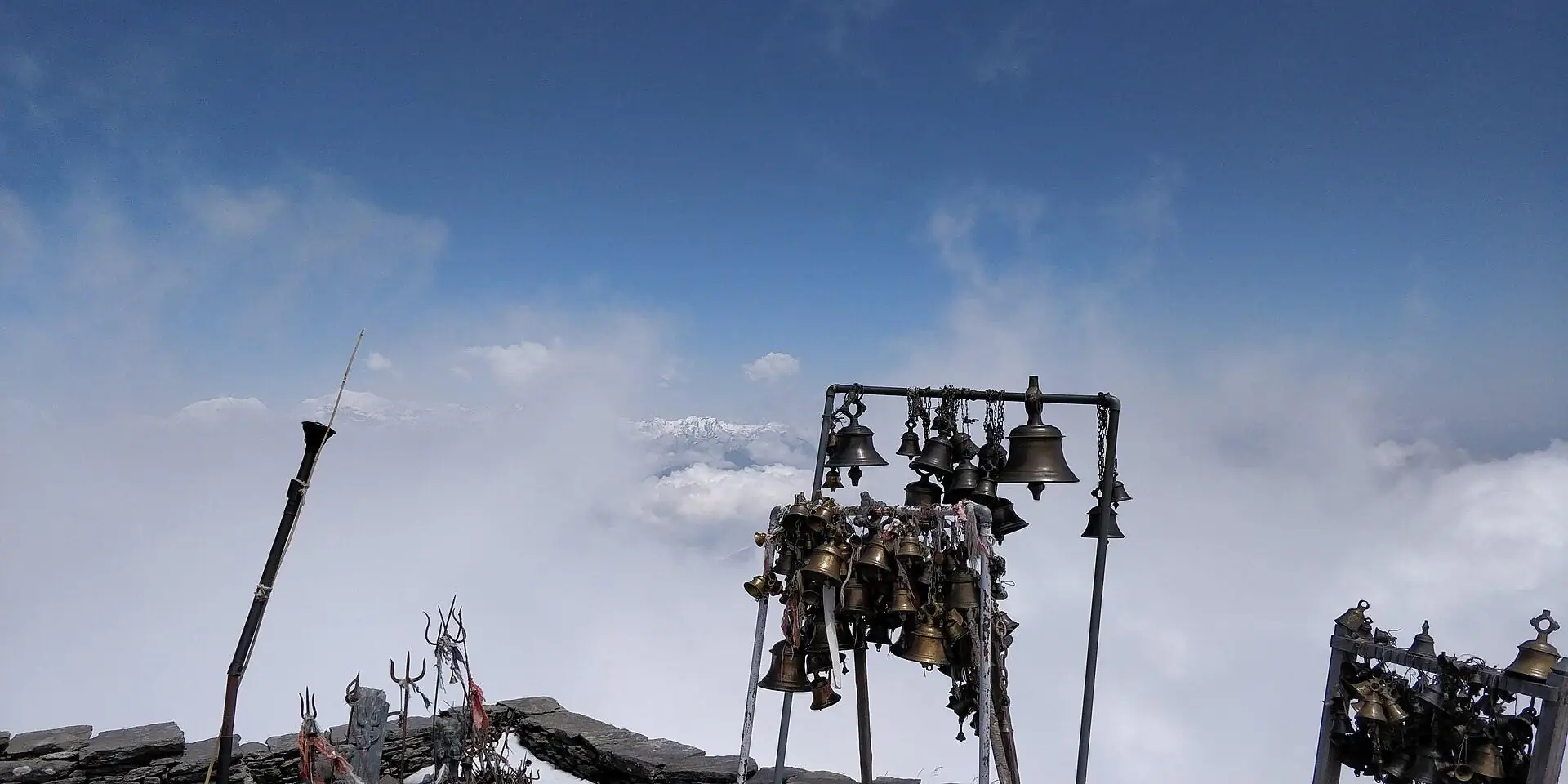
Sacred bells of Badimalika Temple standing above a sea of clouds

Bajura District · Sudurpashchim · Far-West Nepal

Badimalika

A temple above the clouds, and the long road to reach it. A practical travel & pilgrimage guide — route, temple culture, best time, difficulty and packing.

Explore the guide ↓
≈ 4,200 m — temple altitudePilgrimage trek — remote & sacredUpdated 2026 — verify before travel

What is Badimalika?

Badimalika is a sacred hilltop in Bajura, Far-West Nepal — the temple of Malika Bhagwati set on open highland meadows, reached the old way: by long roads, high trails and faith. It is less commercial than Everest or Annapurna, and more honest — the journey bends to weather, festivals and local rhythm.

Made for

  • Pilgrims & devotees
  • Culture-focused travelers
  • Photographers of quiet places
  • Remote-region explorers

Not for

  • Luxury-first travel
  • Tight plans without buffer days
  • Guaranteed comfort & connectivity
  • Checklist summit-bagging
≈4,200 mTemple altitude*
BajuraDistrict
SudurpashchimProvince
Moderate +Difficulty · weather-led
Spring · AutumnClearest windows

* Commonly cited figure. Roads, weather, facilities and festival dates change — verify locally before you travel.

Route & access — how to reach BadimalikaThe road ends. The trail begins.

There is no single door to Badimalika. Access shifts with weather, road works and festival crowds — this is the shape of the journey most travelers follow.

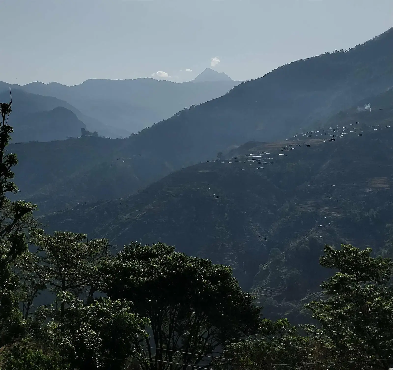
Layered blue ridgelines of Far-West Nepal with a distant peak

Fly west

Kathmandu to Dhangadhi or Nepalgunj — the gateways of the Far-West. The ranges of Sudurpashchim open in layers of blue.
Vast high slopes near Bishnumuhan, Bajura, with tiny trekkers on the trail

The long road

Mountain roads wind toward Bajura — Martadi or Kolti — by bus and local jeep, as weather and road conditions allow.
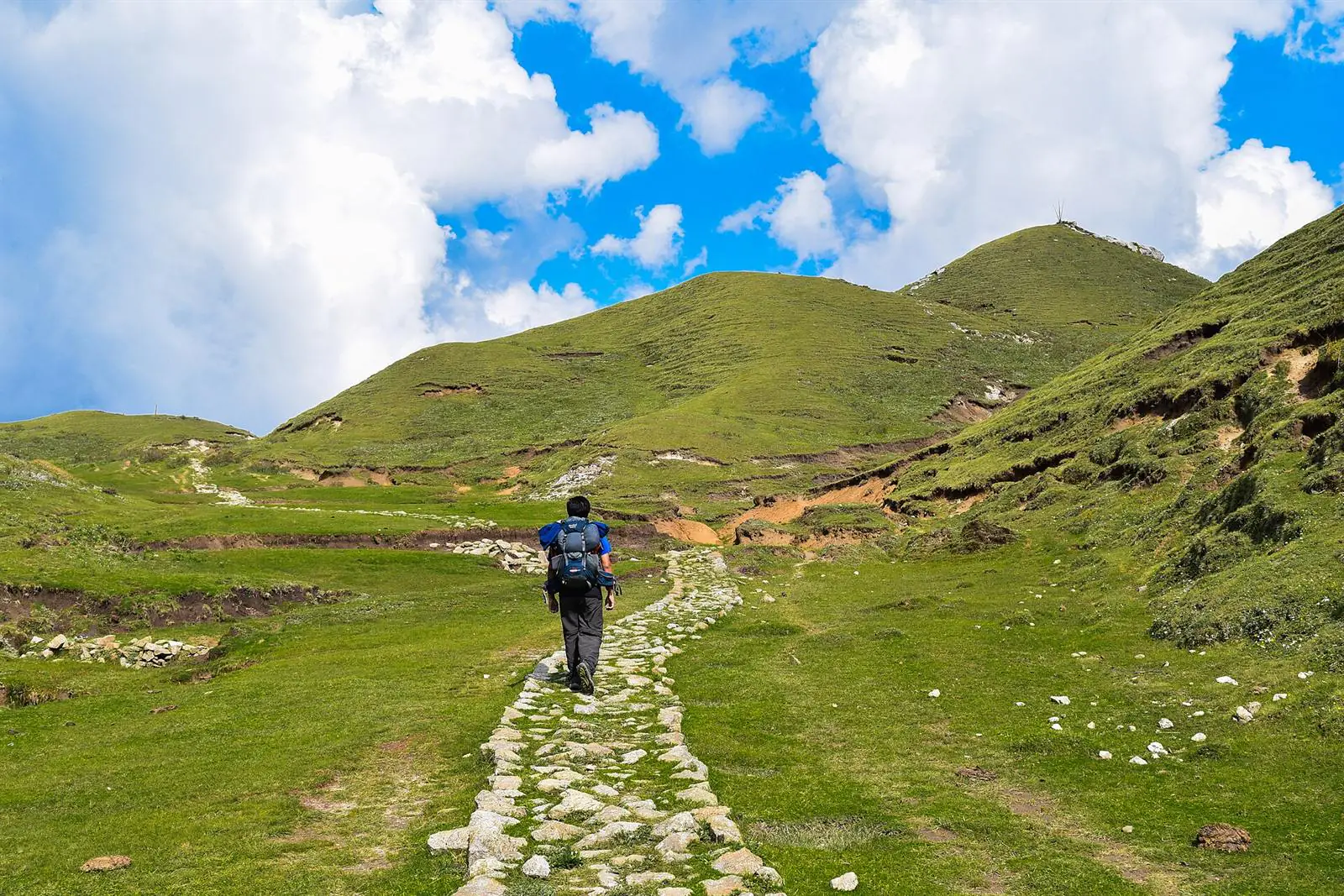
Stone-paved trail crossing green meadows toward rounded summits

Villages & patans

Where the jeeps stop, footsteps begin — stone paths through villages, forest and the wide highland meadows.
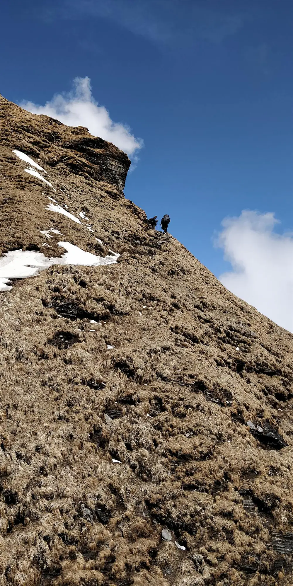
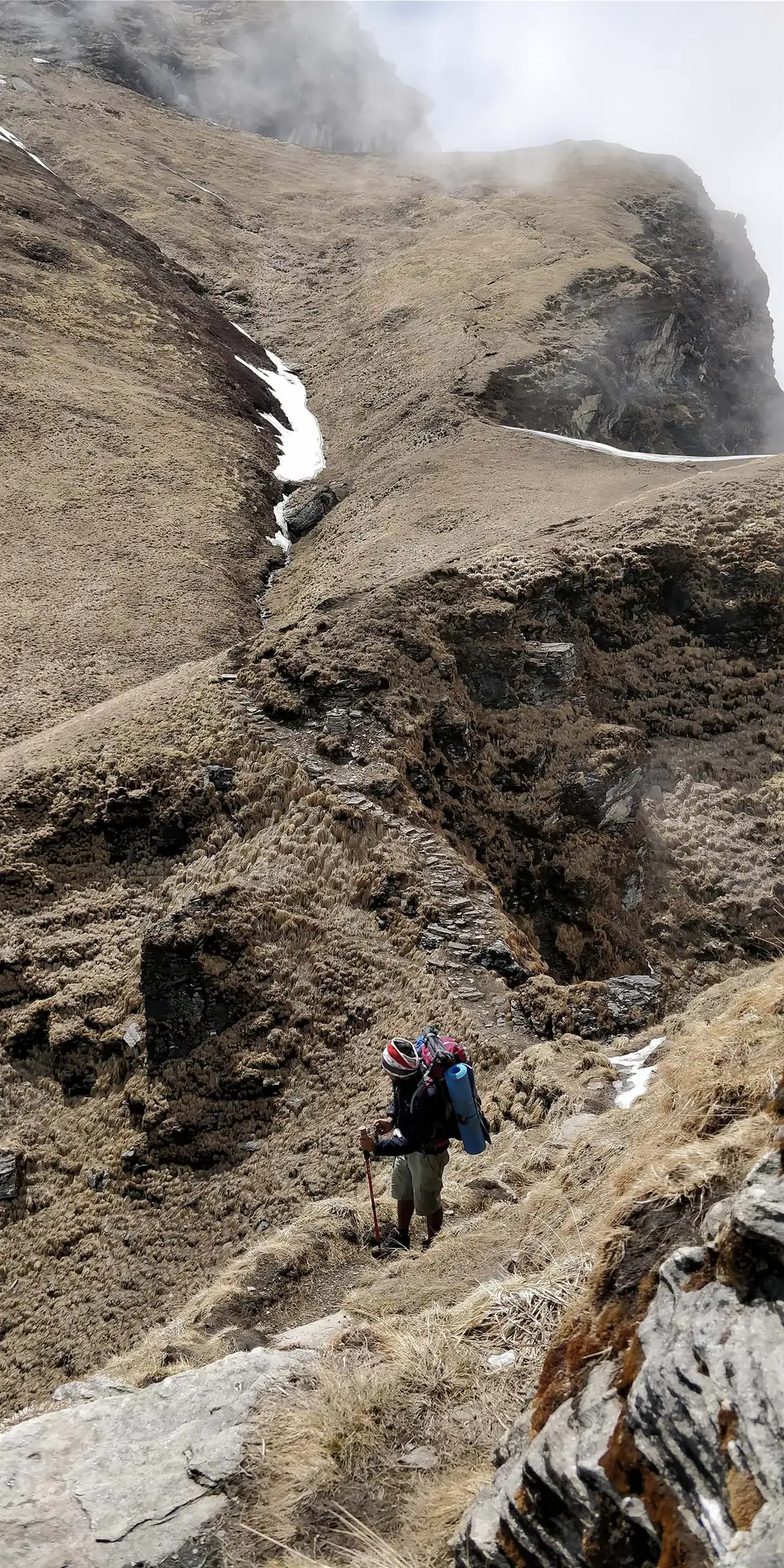
A trekker climbing a steep golden hillside trail into the mist

The climb

High trails rise above the treeline — past shepherd huts, snow patches and passing cloud.
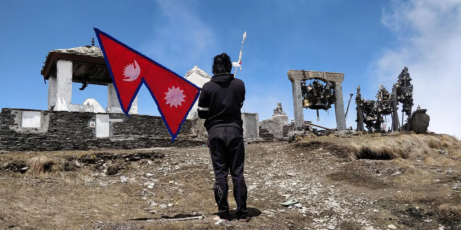
A pilgrim holding Nepal's flag before Badimalika Temple and its bells

The shrine

Badimalika Temple — stone, bells, flags and wind at roughly 4,200 metres. Arrive slowly. Stay respectful.
The full itineraryTen days, told slowly.

Fly west, ride the long roads into Bajura, walk to the goddess at 4,200 metres — then come down the far side to the plains. We wrote the whole route as a story, one day at a time.

  • 10 days, door to door
  • High point ≈4,200 m
  • Flight · jeep · trail
  • Lodges, camps & patans
Walk it day by day
The ten chapters
  • 01Kathmandu → Dadeldhura1,800 m
  • 02The long road to Jadanga3,820 m
  • 03Jadanga → Budha Krodh2,700 m
  • 04The longest day → Triveni3,870 m
  • 05Badimalika Temple4,200 m
  • 06Down to Dhawalpur Lake2,556 m
  • 07Natyashwori → Lamagadh2,195 m
  • 08Rivers down to Mahendranagar220 m
  • 09Back to Dhangadhi110 m
  • 10Fly home to Kathmandu1,400 m
Read the full story →

Temple & pilgrimageA shrine first. A trek second.

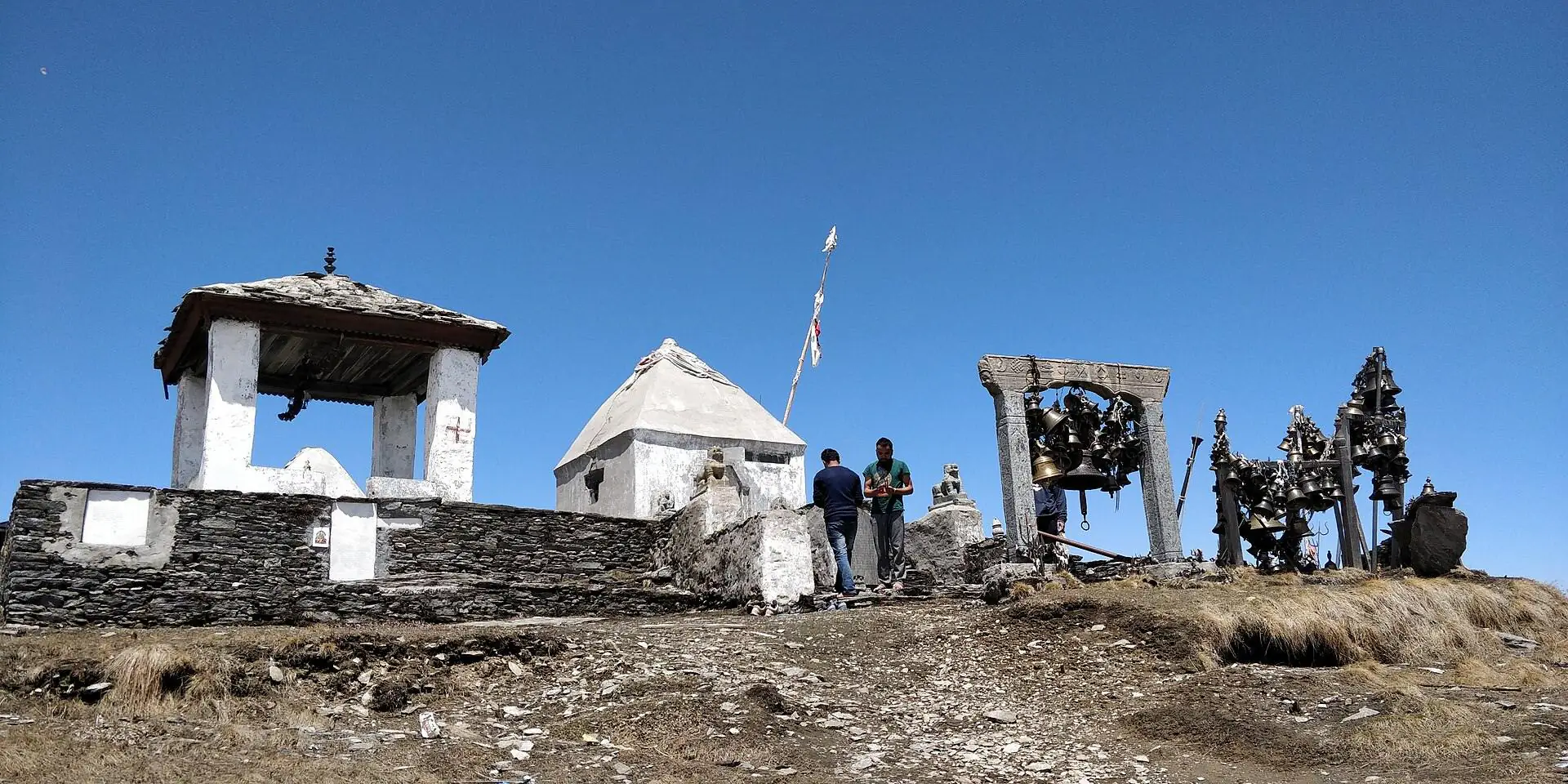
Badimalika Temple complex with its stone shrines and hanging bells

Badimalika is a living pilgrimage site — the temple of Malika Bhagwati, tended by local tradition and linked in worship with Triveni and Natyashwari. During the great festival, pilgrims cross the meadows in their thousands; dates shift each year, so verify before planning around them.

  • 01Dress modestly around the temple and shrines
  • 02Ask before photographing people or rituals
  • 03Keep quiet near worship — let ceremonies lead
  • 04Follow local guidance during festival days
  • 05Carry every piece of your waste back down

“Arrive as a guest, not a customer.”

Best time to visit BadimalikaChoose your window.

Mar — May

Spring

Snowmelt, fresh patans and kinder walking days. The safest all-round window.

First-timers
Sep — Nov

Autumn

Washed skies after monsoon and the longest views of the year. Cold, clear ridge mornings.

Photographers
Verify dates

Festival

Pilgrims climb in their thousands and the meadows fill with faith — along with rain, crowds and hard logistics.

Pilgrimage
Jun — Aug · Dec — Feb

Monsoon & winter

Slick trails, road delays, snowbound passes. Only with buffer days, local support and experience.

Think twice

Purpose decides the season: clearer weather → spring & autumn · pilgrimage atmosphere → festival period · quieter trails → non-festival months.

Difficulty · safety · packingDemanding, not technical.

The challenge is not climbing — it is remoteness. Long road days, changing weather, thin facilities, little signal. Prepare for the region, and the trail will take care of itself.
Promise yourself

  1. Check road and weather conditions right before departure
  2. Keep two or three buffer days — delays are normal here
  3. Carry enough cash; there are no ATMs on the route
  4. Confirm food and sleeping arrangements in advance
  5. Pack personal medicine and a small first-aid kit
  6. Travel with local support if the region is new to you

In the bag

  • Warm layers
  • Rain shell
  • Broken-in shoes
  • Headlamp
  • Power bank
  • Water purification
  • Snacks
  • Cash & ID
  • Modest temple wear
  • Waste bag

Leave behind the expectation of

  • Luxury lodges
  • Stable internet
  • Guaranteed road access
  • Full menus
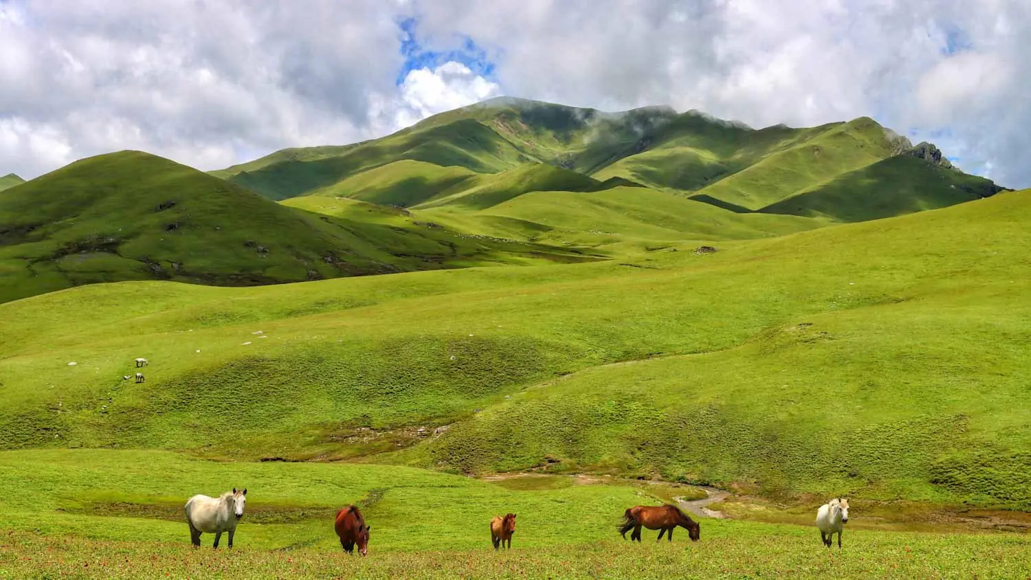
Horses grazing on the green highland meadows below Badimalika

Responsible travelSmall promises, kept up
high.

  • 01Carry your waste back down.
  • 02Ask before you photograph.
  • 03Walk quietly near the shrine.

Badimalika Trek FAQsAsked, answered.

Where is Badimalika located?
Badimalika sits in Bajura District of Sudurpashchim Province, Far-West Nepal — among high open meadows at roughly 4,200 metres.
Is Badimalika a trek or a pilgrimage?
Both. Many visit for pilgrimage to the Malika Bhagwati temple, while others experience it as a remote cultural and nature trek.
How do you reach Badimalika?
Usually by flight or road to western Nepal (Dhangadhi or Nepalgunj), onward road travel toward Bajura — Martadi or Kolti — then walking sections that depend on route and season.
How difficult is the trek?
It is not technical, but it is demanding: long road days, remoteness, changing weather, basic facilities and uneven trails. Fitness and buffer days matter more than technique.
When is the best time to visit?
Spring and autumn are usually best for weather and walking. The festival period has the strongest pilgrimage atmosphere — verify dates and conditions each year.
Are facilities available on the route?
Facilities are basic and route-dependent. Some sections have local stays or seasonal shelters; others may need camping or prior arrangements. Confirm before departure.
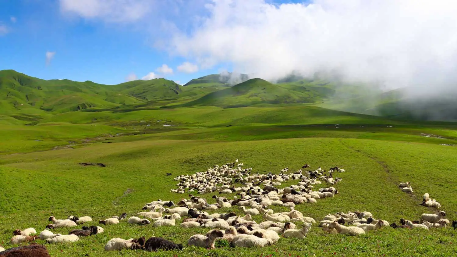
A flock of sheep resting on the green patans below Badimalika, clouds rolling in
Still researching Badimalika?

Ask, before you commit.

Routes, roads, weather and festival dates change every season. Send your question and we will point you toward the right information.

Some resources may link to travel-planning partners where travelers can compare options or request help from verified agencies. BadimalikaTrek.com remains an informational resource first.

Ask a question

The mountain is far. The answer is close.

Opens WhatsApp with your message prefilled — nothing is sent until you press send there.